Estero Bay to Pine Island: Boating Buyer Notes
Buyers who have spent time in Charlotte Harbor sometimes assume the water south of it works the same way. It does not. The harbor is a large, relatively open, relatively deep estuary with a famous deep pass at its western corner. The water from Pine Island Sound down through San Carlos Bay and into Estero Bay is a different animal — shallower, more intricate, more mangrove than open water, and threaded with a marked channel that you leave at your own risk.
That is not a criticism. Some of the best fishing water in Florida is right there, and the islands are extraordinary. But it changes which house you should buy, and it changes it more than most buyers expect.
The Waters South of the Harbor
Working from north to south, the system runs roughly like this. Pine Island Sound lies between Pine Island on the east and Sanibel and Captiva on the west, opening to the Gulf through a set of passes — Boca Grande Pass at the far north end of the system, then Captiva Pass, Redfish Pass, and Blind Pass between Sanibel and Captiva, which has a long history of shoaling and periodic closure. Matlacha Pass runs down the other side of Pine Island, between the island and the Cape Coral mainland. The two join at the south end near San Carlos Bay, where the Caloosahatchee empties and the Sanibel Causeway crosses. South of that is Matanzas Pass at Fort Myers Beach, and then Estero Bay behind Estero Island, Lovers Key and the barrier chain, with Big Carlos Pass at the south end of Fort Myers Beach.
The Gulf Intracoastal Waterway runs down through Pine Island Sound and into San Carlos Bay, and the Okeechobee Waterway heads inland up the Caloosahatchee from Fort Myers. If you are cruising rather than fishing, that intersection is a genuine advantage of the area — you can run north inside, or turn east and cross the state.
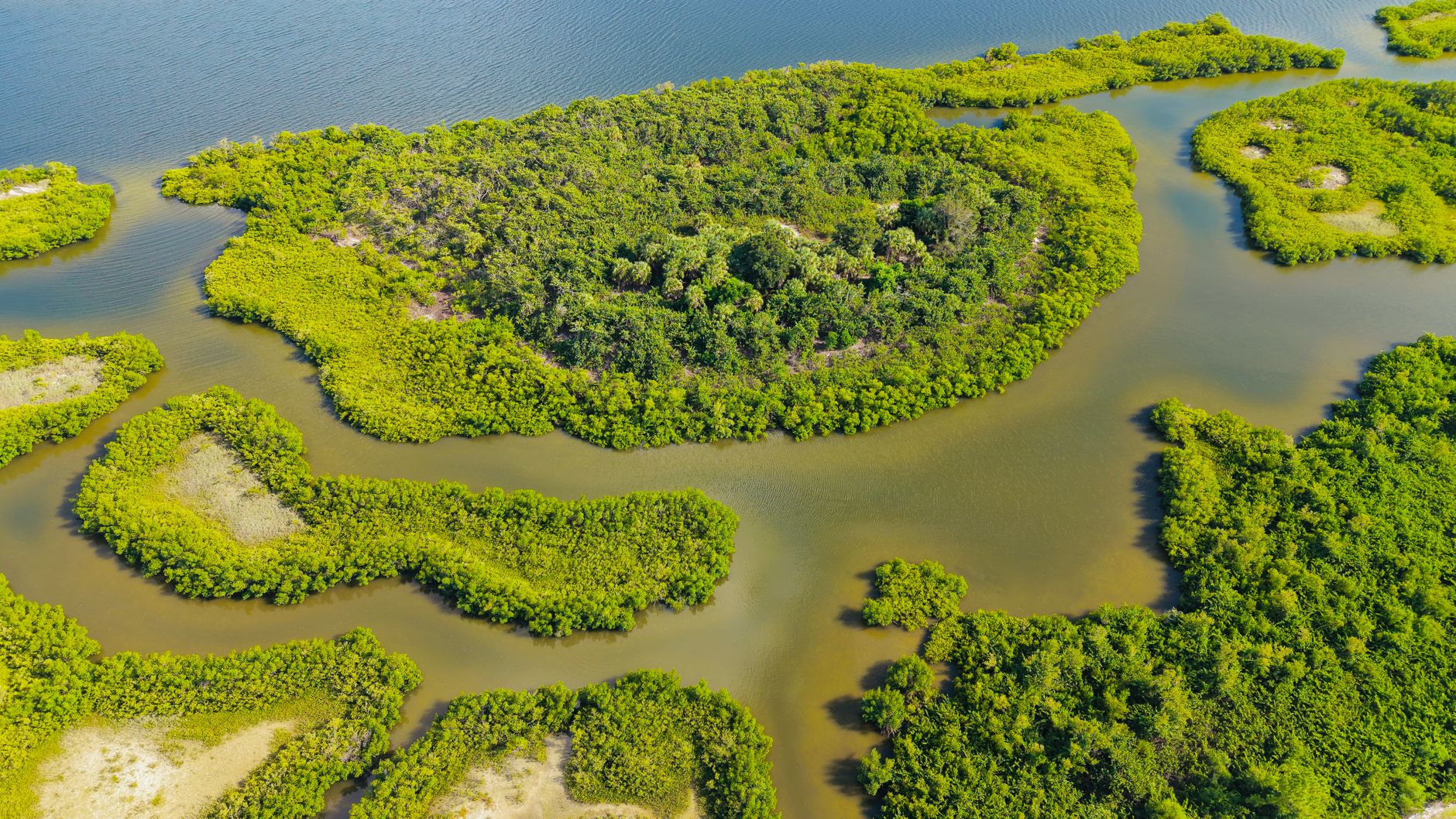
Estero Bay is worth calling out separately. It was designated Florida’s first state aquatic preserve, and the character shows: shallow, richly vegetated, heavily mangroved, wonderful for small boats and unforgiving of large ones.
Pine Island Sound and Its Character
Pine Island Sound is wide and it is shallow. There is a marked channel, and there is everything else, and the everything else includes extensive seagrass beds, oyster bars, and flats that are ankle-deep on a strong low tide. Seagrass here is a protected resource, and scarring it with a propeller is both an environmental problem and a legal one. Much of the area also carries manatee protection speed zones, which are posted and enforced.
The practical effect on a boating buyer is this: in Pine Island Sound you do not travel in a straight line. You travel the channel. Your run time to a pass is measured along the marked route, not across the chart with a ruler. Two homes that look equally close to Captiva Pass can be twenty minutes apart in real time because one of them sits near a channel entrance and the other requires a long dogleg to get to the same water.
Pine Island itself — Bokeelia at the north end, Pineland on the west side, St. James City at the south — has a distinctly unhurried character, and access differs sharply by end of the island. St. James City sits near the southern approach; Bokeelia sits close to the north end and Charlotte Harbor. That is a meaningful difference if the water you fish is at one end and you live at the other.
Matlacha and Bridge Considerations
Matlacha is the small, brightly painted community on the water between Cape Coral and Pine Island, strung along Pine Island Road. It is charming, it is genuinely a fishing town, and for buyers it is also the location of the one structure everyone needs to understand: the drawbridge over Matlacha Pass.
It is a bascule bridge, meaning it opens. When it is down, vertical clearance is low — low enough that most vessels with any real height need an opening. Opening schedules and any restrictions are set by regulation and can change, so if this bridge sits between a prospective home and the water you want to fish, confirm the current opening schedule directly through the Coast Guard’s Local Notice to Mariners and by calling the bridge tender before you buy. Do not rely on a listing description or a neighbor’s memory.
The same logic applies to every fixed structure in the region, including the Sanibel Causeway spans across San Carlos Bay and the Big Carlos Pass bridge at the south end of Fort Myers Beach. If your vessel has a tower, a hardtop, an arch or a mast, the controlling clearance on your route is the single most important number in your home search, and it must be checked against current charted clearance and the tide, not against an old figure. Sailboat owners in particular should map every fixed bridge on the intended route before making a shortlist. The same discipline applies farther north — see Cape Coral’s bridge-restricted versus direct-access canals, where the exact same issue prices homes very differently a mile apart.
Shallow Water and Draft Planning
Draft is the second filter, and it is not just about your keel.
- Know your actual loaded draft, with fuel, gear, people and a lower unit down — not the manufacturer’s brochure number.
- Understand tidal range and timing for your specific area. Depths on a chart are referenced to a datum; a strong low, especially with a north wind pushing water out, can put real water below charted depth. Buyers who only ever tour at high tide learn this expensively.
- Ask about the depth at the dock face at low tide, and get it verified rather than described. A lift solves a depth problem at the dock; it does not solve a depth problem in the canal leading out of it.
- Ask about the depth of the canal or creek the whole way to open water, not just the last hundred feet. Dead-end canals silt in over time, and dredging a private canal is a permitting exercise, not a weekend project.
- Match the boat to the water, or the water to the boat. A flats skiff or a bay boat opens up nearly the entire region. A deep-V sportfish narrows it dramatically. Neither is wrong, but pretending the constraint does not exist is.
Where Home Location Saves Run Time
Some concrete geography-driven observations:
- Proximity to a pass beats proximity to open water on a map. The pass is your door. A home twenty minutes from Captiva Pass by channel is better positioned for offshore running than a home that is nearer the Gulf as the pelican flies but requires forty minutes of channel to reach a usable opening.
- South Cape Coral versus northwest Cape Coral is a real distinction. Homes along the Caloosahatchee side reach San Carlos Bay and the river quickly; homes on the northwest canal network reach Matlacha Pass. Which is better depends entirely on where you want to end up.
- The Caloosahatchee side buys you the Okeechobee Waterway and easier access to Fort Myers Beach, Sanibel and the offshore fleet. The Matlacha Pass side buys you the sound and the islands.
- Estero Bay properties trade offshore convenience for backwater immediacy. Matanzas Pass and Big Carlos Pass are close, but the bay itself is shallow and the run to either can involve slow zones that add real minutes.
- Slow-speed and manatee zones are part of the run time. Two miles at idle is not two miles at cruise. Have someone actually run the route with you at a normal hour before you commit to a location.
Marinas, Fuel and Haul-Out Options
Even with a private dock, you need shoreside infrastructure, and it is worth mapping before you buy rather than after.
Things to identify within a reasonable distance of any prospective home:
- Fuel on the water. Running to the pass and then back inland for fuel is a chore that gets old quickly.
- A yard that can haul your boat’s length and weight. Bottom paint, running gear, engine work and hurricane haul-outs all depend on it. Capacity varies widely, and the constraint is often travel-lift size or approach depth, not willingness.
- A dry stack or covered storage option, which for many owners in this region is a better answer than a lift, particularly for smaller boats and for part-time residents.
- A mechanic who will actually come to your dock, and whether your canal is accessible to a service vessel.
- Ramp access as a backup, and whether the nearest ramps are chaotic on weekends.
- A plan for storm season. Where does the boat go, who moves it, and how much notice does that facility require? Ask this question during the purchase, not in June.
Aligning the Search With Your Boat
The exercise I run with boating buyers is deliberately backwards from how most people search.
- Define the boat. Length, beam, loaded draft, and the tallest fixed point above the waterline. If the boat is hypothetical, define the largest boat you might realistically own within ten years, because the house will outlast this one.
- Define the destinations. Offshore reef and wreck fishing, sound and flats fishing, cruising north inside, crossing the state, or lunch at an island restaurant. These pull toward different geography.
- Derive the constraints. Minimum depth at low tide, maximum acceptable run time, and the controlling bridge clearance on each candidate route.
- Only then look at houses, filtering out entire areas that fail the constraints rather than falling for a kitchen in a location that will frustrate you every Saturday.
- Sea-trial the location. Before closing, run the actual route from the actual dock at an actual low tide. Nothing in a listing substitutes for this.
If you are also weighing the water north of here, Charlotte Harbor’s waterfront geography behaves very differently and is worth comparing directly.
Buyers who do it in this order end up with a smaller shortlist and a much better outcome. Buyers who fall in love first and check the water second are the ones who sell in three years.
If you are weighing Cape Coral, Pine Island, Matlacha or the Estero Bay corridor and want the honest version of what your boat can and cannot do from a given address, reach out to Sabatino Campilii, Realtor®, License SL3363040.
Sabatino can answer it in five minutes — no pressure, no listing-agent spin.

Realtor®, License SL3363040
25-year builder, developer, and licensed Realtor® representing buyers and sellers across the Southwest Florida Gulf-coast pockets. Reviewed and published July 24, 2026.
Have Sabatino represent you — before you call any listing agent.