The short answer
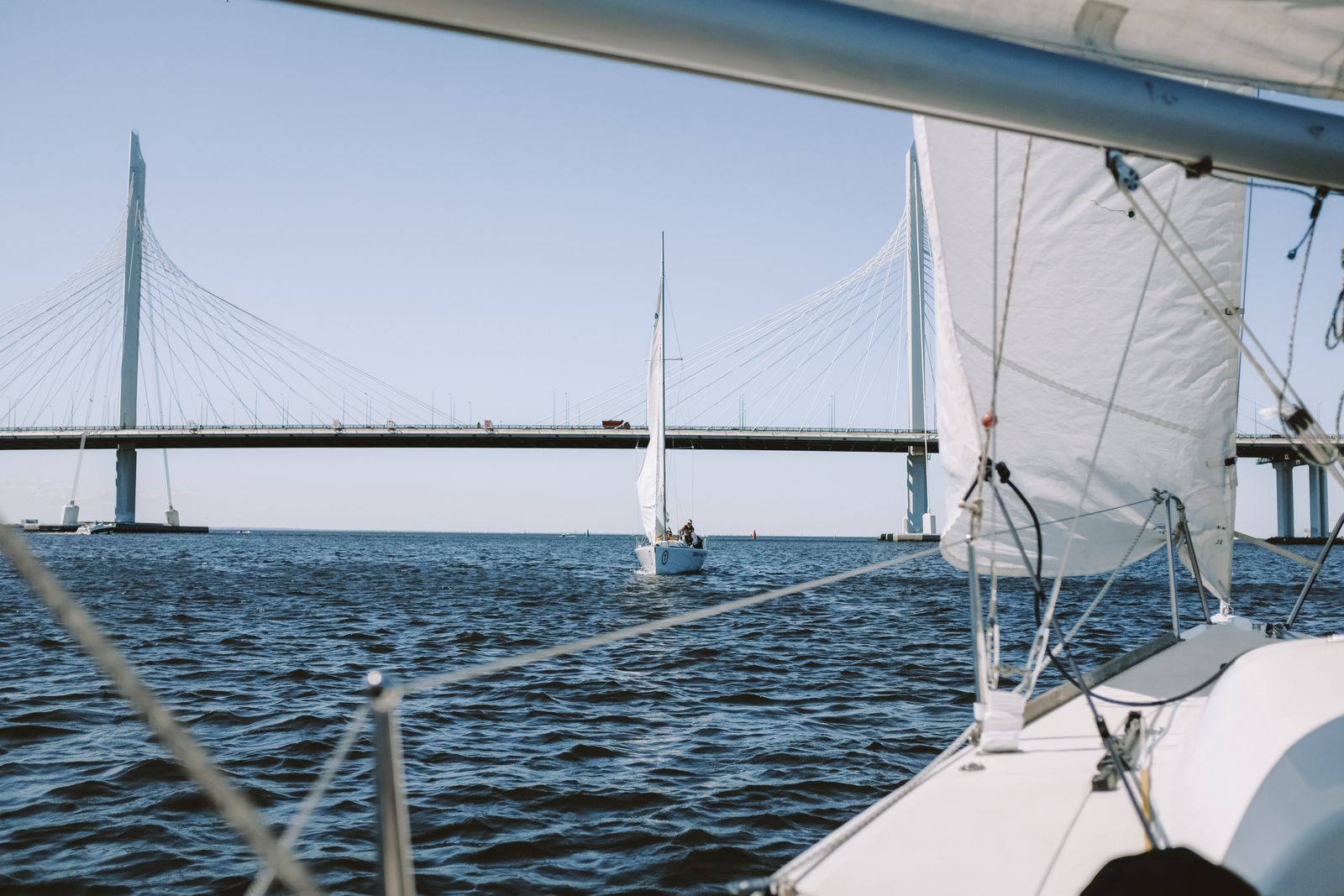
- —A fixed bridge between your dock and open water sets a hard ceiling on the boat you can keep there.
- —'Sailboat access' should mean no fixed bridges on the route — but verify it, never assume it.
- —Charted clearance is referenced to a tidal datum; real clearance changes with the tide and with conditions.
Understanding Bridge Clearance on SW Florida Canals
There is one mistake that costs Southwest Florida waterfront buyers more money than any other, and it isn’t the roof or the seawall. It’s buying a canal home and discovering afterward that the boat they own — or the boat they intended to buy — cannot get out. Anyone searching sailboat access canal florida is already halfway to understanding why. Here is the rest of it. Bridge height on these canals varies block by block, so pair this with our Port Charlotte neighborhood buyer’s guide before you commit to a boat that needs to clear them. Bridge height is one of the first things to check before assuming a canal home offers true gulf access, and our gulf-access canal buyer’s guide for Cape Coral covers that in more detail.
I’m Sabatino Campilii. I work the canal markets around Charlotte Harbor and down the Gulf coast. This is the verification process I put every waterfront buyer through, and I have never once regretted the hour it takes.
Why Bridge Clearance Limits Your Boat
Every boat has an air draft — the vertical distance from the waterline to its highest fixed point. For a center console that might be the top of the T-top or the antenna; for a flybridge cruiser it’s the hardtop or the radar arch; for a sailboat it’s the masthead, including the wind instruments and the VHF antenna sitting above it.
Every fixed bridge has a vertical clearance — the distance from the water surface to the underside of the span.
The arithmetic is unforgiving. If your air draft exceeds available clearance at any bridge between your dock and open water, that boat does not leave your canal. There is no workaround, no negotiation, and no waiting for a better day. Some boats can lower antennas or towers to gain a bit of margin, and sailboats can sometimes be heeled in specialized situations, but you should never buy a house on the assumption that you’ll be squeezing under a bridge.
This is why waterfront listings on this coast talk endlessly about access, and why the language deserves scrutiny.
Fixed Bridges vs Open Water Routes
Not all bridges are equal, and the distinction matters.
Fixed bridges do not move. Their clearance is what it is. These are the hard constraint.
Movable bridges — bascule, swing, or lift spans — open for vessel traffic. They have a closed clearance and effectively unlimited clearance when open. The Boca Grande Causeway to Gasparilla Island includes a movable span, for example. Movable bridges introduce schedule considerations — opening restrictions, operating hours, and waiting — but they are not an absolute ceiling.
Overhead obstructions that aren’t bridges. Power lines cross waterways too, and they have their own charted clearance with a safety margin that should be taken seriously rather than tested. Do not overlook them when tracing a route.
The critical framing: it is not the nearest bridge that matters, it is the lowest one on the entire route to open water. A canal that looks wide open at the dock can have a low span three miles downstream. Trace the whole route, every time.
What ‘Sailboat Access’ Actually Means
In Southwest Florida listing language, “sailboat access” is generally used to mean the route from that dock to open water crosses no fixed bridges. “Bridgeless access” and “direct Gulf access” get used similarly.
Treat all of these as claims to be verified, not facts. Reasons:
- Nobody certifies them. These are marketing descriptions written by people who may or may not have traced the route.
- They are inherited. A phrase written into a listing in 2003 gets copied forward through every subsequent listing of that property, long after anyone checked.
- “Access” is vague. Access to what? Charlotte Harbor is not the Gulf. Reaching a bay is different from reaching open ocean water. Ask which body of water, specifically.
- The route may have alternatives. Some canals offer two routes out, one with a bridge and one without, at very different distances. Confirm which one the claim refers to.
The same skepticism applies to “power boat access,” “Gulf access in minutes,” and any minutes-based claim. Minutes depend on the boat, the route, idle zones and manatee zones. Those speed-restricted zones are real and enforced, and they can turn a claimed fifteen-minute run into something considerably longer.
For how this plays out in specific markets, see the Cape Coral Gulf-access canals guide and Punta Gorda Isles vs Burnt Store.
Tide and Water Level Effects on Clearance
Charted vertical clearance for a fixed bridge is not a single physical fact — it is a measurement referenced to a tidal datum, commonly mean high water. That means:
- At low tide, you have more clearance than charted.
- At high tide, you have roughly the charted amount — or less.
- Under elevated water conditions, you can have significantly less. Sustained onshore wind, heavy rainfall events, and seasonal high tides all raise water levels above ordinary predictions.
Some bridges carry clearance gauges — boards mounted on the piers showing the current available clearance. Where they exist, use them. They tell you the truth in the moment, which the chart cannot.
The planning implication is that you should not size your boat to the charted clearance. You size it to charted clearance minus a real safety margin, so that a high tide with a wind behind it does not strand you outside your own canal — or worse, put you into the span.
The same tidal logic runs the other way underneath the boat. A canal with adequate depth at high tide may not float your boat at low tide. Depth and clearance are two constraints on the same trip, and they move in opposite directions. Check both at both ends of the tide range.
Mapping Your Route to Open Gulf Water
Do this before you make an offer, in this order:
- Get the exact dock location. The parcel, the canal, and where on that canal the dock sits.
- Trace the water route on a current chart. Use current NOAA nautical charts for the area. Follow the water from the dock all the way to the open Gulf, noting every bridge, every power line crossing, and every place the channel narrows or shoals.
- Record the controlling clearance. The lowest fixed clearance on the route is your ceiling. Write down that number and where it is.
- Record the controlling depth. The shallowest charted point on the route at low water is your draft limit.
- Note speed-restricted zones. Manatee protection zones and idle-speed areas determine actual travel time far more than distance does.
- Compare against your boat. Air draft including antennas and any tower, plus draft with the boat loaded — not the brochure figures.
- Verify on the water. The single best diligence step available to you is running the route in a boat with someone who knows it. A local captain, a marine surveyor, or a boat-owning neighbor will teach you more in ninety minutes than a week of reading.
How to Verify Clearance Independently
Sources worth trusting, roughly in order:
- Current NOAA nautical charts for charted vertical clearances and depths. Make sure you’re on a current edition, not a printed chart from years ago.
- Clearance gauges on the bridge itself, read at the tide you care about.
- The bridge owner — Florida Department of Transportation for state-maintained bridges, or the county for county-maintained spans. They hold the as-built records.
- The U.S. Coast Guard district for regulations governing movable bridge operation, including any opening restrictions.
- Local marine professionals — marina staff, marine surveyors, boatyards and captains who run the water daily. They know which spans are tighter than the chart suggests and how the water actually behaves.
Sources not worth trusting: the listing, the seller’s memory, a neighbor’s confident estimate, and an internet forum post of unknown vintage.
If your purchase genuinely depends on being able to run a specific vessel out to the Gulf, make that a written contingency. It is a reasonable thing to ask for and a reasonable thing to verify inside an inspection period.
Matching the Boat to the Canal
The cleanest way to approach a waterfront search is to reverse the usual order. Decide the boat first, then filter the houses.
Write down, honestly:
- The vessel you own or will buy, with real air draft and real loaded draft.
- Where you actually intend to go — flats fishing in the harbor, offshore runs into the Gulf, cruising the Intracoastal, or day sailing.
- How often. A boat you use twice a month justifies different compromises than one you use twice a week. Bridge clearance is only part of the picture — our guide to fishing access and home location on Charlotte Harbor explains why a home’s exact spot on the harbor matters as much as the route out.
Then have those requirements drive the search. A buyer who needs bridgeless sailboat access is shopping a genuinely limited set of properties on this coast, and knowing that from the start saves a great deal of wasted touring and disappointment. A buyer with a twenty-two foot bay boat has enormously more options and should not pay a premium for access they will never need.
Getting this right is the difference between a waterfront home that delivers what you bought it for and one that becomes a very expensive view.
If you’re evaluating a canal property and want the route traced and the clearances confirmed before you write an offer, reach out. I’ll go through the charts with you and, where it matters, get you on the water to see it yourself.
Sabatino can answer it in five minutes — no pressure, no listing-agent spin.

Realtor®, License SL3363040
25-year builder, developer, and licensed Realtor® representing buyers and sellers across the Southwest Florida Gulf-coast pockets. Reviewed and published June 5, 2026.
Frequently asked
What does sailboat access mean on a Florida canal listing? +
It is generally used to mean the route from that dock to open water crosses no fixed bridges, so a vessel with a tall mast can pass. It is a marketing term, not a certified measurement. Verify the actual route on current NOAA charts and confirm every span between the dock and open water.
Does bridge clearance change with the tide? +
Yes. Charted vertical clearance for a fixed bridge is referenced to a tidal datum — commonly mean high water. Actual available clearance is greater at low tide and less at high water, and can be further reduced by wind-driven or seasonally elevated water levels.
Have Sabatino represent you — before you call any listing agent.