Charlotte Harbor Fishing Access and Home Location
Most buyers who fish choose a house and then figure out the fishing. The ones who end up happiest do it the other way around: they decide what they want to fish, work out where that water is, and then look at houses within a sensible run of it.
Charlotte Harbor makes that approach worthwhile, because it is large enough that the fishing genuinely changes depending on where you launch. This is a guide to thinking about the water first.
Let the Water You Fish Guide the Search
Charlotte Harbor is one of Florida’s major estuaries — a broad, comparatively shallow system fed by the Peace River and the Myakka River at its northern end, opening south and west through Gasparilla Sound and Pine Island Sound, with Boca Grande Pass connecting it to the Gulf of Mexico at the south end of Gasparilla Island. Much of the harbor and its shoreline falls within an aquatic preserve and the Charlotte Harbor Preserve State Park system, which is a significant part of why the fishery has held up.
The practical consequence for a buyer is that “on Charlotte Harbor” describes a very large area with very different fishing at each end. A house at the mouth of the Peace River in Punta Gorda and a house in Placida are both harbor properties, and they support different days on the water.
Start with a specific question: what do I want to be doing at seven in the morning most weekends? Poling a flat for redfish. Working mangrove shorelines for snook. Sitting in the pass in tarpon season. Running offshore for grouper and snapper. Fishing the rivers for juvenile tarpon and snook in the cooler months. Each of those points to a different part of the harbor.
Flats, Passes and Harbor Zones
A rough geography, north to south:
The upper harbor and the rivers. The Peace River and Myakka River enter the harbor near Punta Gorda and Port Charlotte — brackish, protected water, fishable when the harbor is blown out and productive for snook and juvenile tarpon in the cooler months. Our Punta Gorda Isles canal homes buyer’s guide covers that market specifically.
The open harbor. The broad middle is shallow and can build a serious chop when the wind is up. On a windy day it is not where you want to be in a small boat, which is why proximity to protected water matters as much as proximity to the harbor itself.
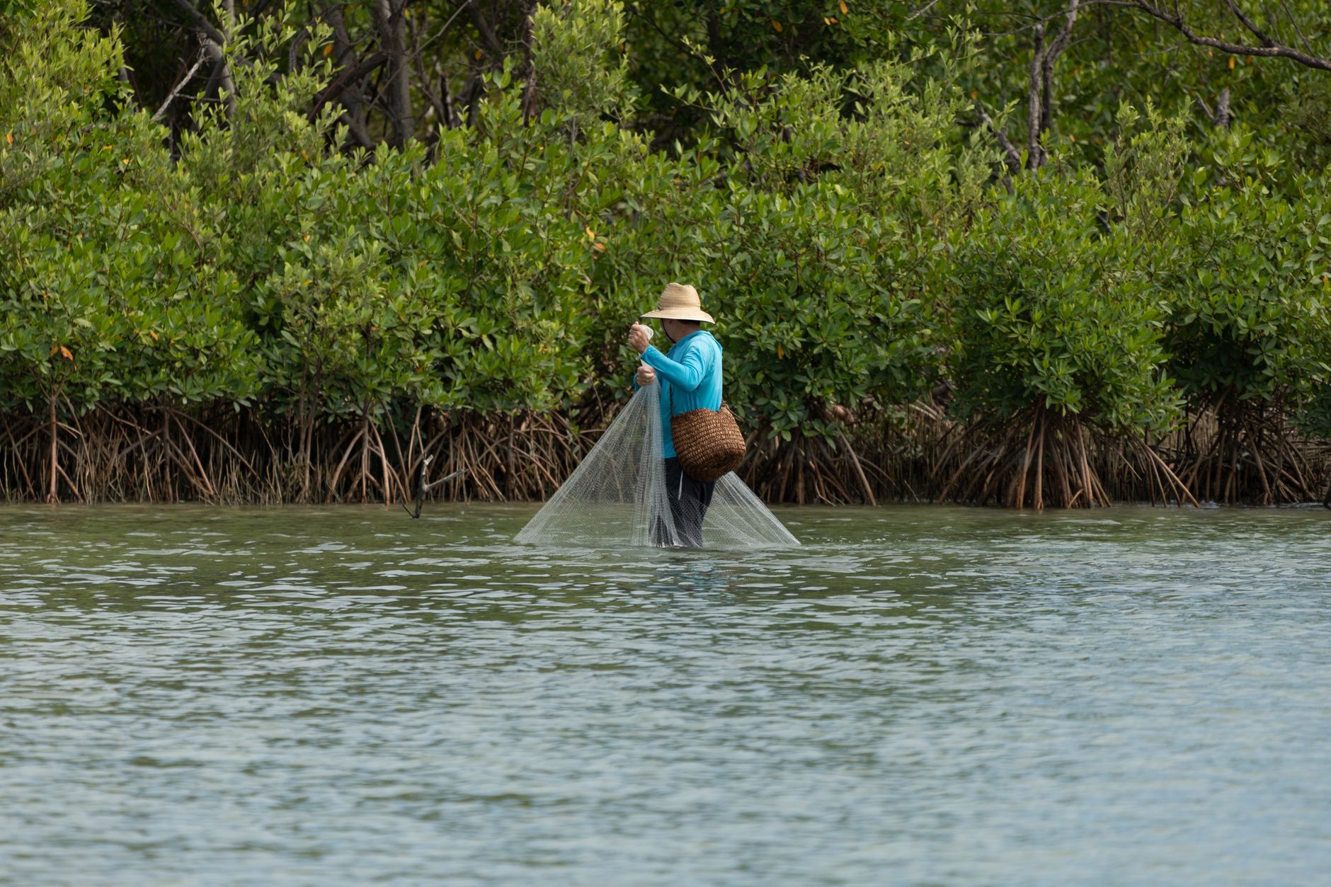
The east and west shorelines and Bull Bay. Mangrove shoreline, flats, and back bays along the harbor’s edges. This is classic Southwest Florida shallow-water fishing.
Gasparilla Sound and the lower harbor. The southern end, behind Gasparilla Island. Protected water, oyster bars, and grass, with quick access to the pass. Placida, Cape Haze, and the Rotonda corridor sit along here.
Boca Grande Pass. The deep pass at the south end of Gasparilla Island, and one of the most renowned tarpon fisheries in the world during the late spring and early summer run. It also provides the shortest, cleanest route to the Gulf from the harbor system. Our post on Boca Grande Pass versus Gasparilla Sound covers how differently those two bodies of water behave.
Offshore. Out through the pass. Run times to productive bottom depend heavily on where you started.
If you want offshore access, being near the pass matters enormously. If you want flats and backcountry, being near a good flat matters and the pass matters much less. Trying to optimize for both usually means accepting a longer run for one of them.
Ramp and Marina Access Points
Even owners with a private dock use ramps — to fish a different part of the harbor, to trailer to another system, or during dock work.
Charlotte County maintains public boat ramps around the harbor, including facilities at Ponce de Leon Park in Punta Gorda, Placida, El Jobean on the Myakka River, and Laishley Park in downtown Punta Gorda, among others. Facilities, parking capacity, and fees vary, and the county’s parks department is the current authority — verify hours and any fee before planning around one.
Marinas around the harbor offer fuel, ice, bait, wet slips, dry stack storage, and service. Note the nearest marina with fuel and the nearest with service — one you can reach by water is worth more than one you can only reach by road.
For buyers considering a home with an assigned or deeded slip rather than a private dock, our post on buying a home with a boat slip or marina rights covers the arrangements and what to verify.
Dock Setup for Anglers
An angler’s dock has requirements a general-purpose dock does not.
Depth at mean low water. This is the number that governs everything. A dock that floats your boat at high tide and grounds it at low tide is not usable on a fishing schedule, because the fishing schedule is set by the tide, not by convenience. Measure it, at low water. Our guide to understanding water depth at your dock explains how to do this properly.
The route out. Depth at the dock means nothing if the canal shoals two hundred yards down, or if a fixed bridge sits between you and the harbor. Verify the full route at low water, and verify clearance for your vessel — see bridge clearance in Southwest Florida canals and our overview of Gulf access tiers.
The lift. Confirm capacity against your boat’s loaded weight, not its dry weight. Check cables, motors, bunks, and whether the lift is properly sized to the hull. In salt air, lift hardware is a maintenance item.
Utilities on the dock. Freshwater for rinsing is not a luxury here, it is what keeps your equipment alive. Power for the lift, for a charger, and for lighting. A properly bonded electrical installation on a dock is a safety matter, not a convenience — have it verified by a licensed electrician.
Permits. Confirm the dock and lift are permitted. Marine construction in Florida can involve county, state, and in some cases federal review, and an unpermitted structure becomes the new owner’s problem.
Boat Storage and Trailer Space
Not every angler keeps the boat in the water, and there are good reasons not to.
Trailer storage at the house. Check the HOA or deed restrictions first — many Southwest Florida communities restrict or prohibit visible boat and trailer storage, and enforcement varies. If you intend to keep a trailer, confirm it is permitted before you buy, not after. Then confirm the physical reality: gate width, driveway length, turning radius, and whether you can back a trailer in without a three-point exercise in the street.
Dry stack storage. Common around the harbor and genuinely practical. The boat stays out of the water, which dramatically reduces bottom growth and corrosion, and the marina launches it for you. The tradeoffs are the monthly cost, operating hours, and the loss of spontaneity — you generally cannot decide at nine at night to go out at five.
Keeping it on the lift. The most convenient option if you have depth and a good lift. Budget for the maintenance the salt environment imposes.
Cleaning Stations and Practical Add-Ons
The things that make an angler’s house work day to day:
- A fish cleaning station with water and, ideally, a light. Where it goes matters — placement affects your neighbors as much as you, and some communities have rules about it.
- An outdoor rinse-down area for gear, with an outdoor shower nearby if possible.
- A rod storage location that is not the garage floor. A garage wall rack is cheap and transformative.
- Freezer capacity for bait, in the garage rather than the kitchen.
- A dedicated place for wet gear so it does not come inside.
- Dock lighting for early departures and late returns.
- Outdoor electrical outlets near the dock and the driveway for chargers and equipment.
None of these are expensive to add, but a house that already has them is telling you it was owned by someone who fished.
Turning Priorities Into a Search Map
Do this exercise before you look at a single listing:
- Name the fishery. Flats, mangrove shoreline, pass, offshore, or river. Pick the primary one honestly.
- Name the boat. Length, draft loaded, and height including any tower. Draft sets minimum depth; height sets bridge constraints.
- Set a tolerable run time. Twenty minutes to the water you named is a different search than forty-five.
- Draw the zone. On a chart, mark the water you want and the area within your run time of it, accounting for idle-speed zones and manatee zones, which are real and enforced throughout this system.
- Apply the constraints. Within that zone, filter to properties with adequate depth at the dock and adequate clearance on the route out.
- Then look at houses.
Buyers who follow that order almost never regret the location. Buyers who reverse it sometimes end up with a beautiful home and a boat that will not clear the bridge.
For a broader picture of the harbor as a real estate market rather than a fishery, our Charlotte Harbor waterfront real estate buyer’s guide and our notes on boating route basics in Charlotte Harbor both cover ground this post does not.
If you want to build that search map for a specific boat and a specific fishery, contact Sabatino Campilii. Starting from the water and working back to the house is a slower first conversation and a much faster search.
Sabatino can answer it in five minutes — no pressure, no listing-agent spin.

Realtor®, License SL3363040
25-year builder, developer, and licensed Realtor® representing buyers and sellers across the Southwest Florida Gulf-coast pockets. Reviewed and published July 7, 2026.
Have Sabatino represent you — before you call any listing agent.