The short answer
- —Public beach access on Gasparilla Island is concentrated at Gasparilla Island State Park on the south end, plus smaller marked accesses near the village and the north island — every access point is metered, and there is no informal roadside parking.
- —The state park operates the most-used public beaches, including Lighthouse Beach at the island's southern tip, each with its own small lot, boardwalk or dune crossover, and fee collection.
- —North of the park, public accesses are smaller and fill early on busy winter weekends, which is a major reason island buyers weight walkability to the beach so heavily.
Gasparilla Island Beaches and Public Access
Gasparilla Island is roughly seven miles long and, in most places, only a few hundred yards wide. That geometry is the single most useful thing to understand about the island’s beaches. There is one continuous Gulf shoreline running the length of the west side, one road — Gulf Boulevard for much of it — running parallel to it, and a finite, well-defined set of places where the public can legally park and walk to the sand.
Buyers who spend a day walking the island north to south almost always change their search criteria afterward. The shoreline is not uniform. Sand character, wave energy, shelling quality, crowd levels, and the walk-to-beach experience all change measurably as you move down the island. Here is how it actually breaks down, and how that geography tends to reshape a home search.
The Island’s Shoreline From North to South
The island sits in two counties. The northern portion falls within Charlotte County; the southern portion, including most of the village of Boca Grande, sits in Lee County. That county line matters less for beach experience than it does for permitting, property records, and code questions — but it is worth knowing which property appraiser’s office you will be pulling records from before you get deep into diligence on a specific address.
Vehicle access to the island is by the Boca Grande Causeway from Placida, on the mainland side of Gasparilla Sound. It is a toll crossing operated by the Gasparilla Island Bridge Authority, and it is the only road on and off. Everything about the island’s beach rhythm flows from that fact: day-trip volume is naturally throttled by a single point of entry.
At the north end, the shoreline is quieter and less developed, with wider undeveloped stretches and fewer formal access points. Moving south, the island narrows and the residential fabric tightens through the historic village. At the extreme south end sits Gasparilla Island State Park, which holds the most heavily used public beaches on the island, along with the Port Boca Grande Lighthouse — the 1890 structure that now houses a small museum — and the shoreline that fronts Boca Grande Pass. Many of the public beach walkovers sit closest to Boca Grande’s historic district, which is part of why homes there hold value so well.
Gasparilla Island Public Beach Access Points and Parking
Public beach access on Gasparilla Island is real and reasonably generous, but it is concentrated, marked, and metered. There is no informal roadside parking culture here; residential streets are posted, and enforcement is consistent.
The state park at the south end operates several designated beach parking areas along Gulf Boulevard, each with its own small lot, boardwalk or dune crossover, and restroom or shower facilities at the larger ones. Entry is by fee, typically collected at an honor box or station. Lighthouse Beach, at the southern tip, and the beach near the Gasparilla Island Light range tower further north within the park are the two most recognized. Because rates and hours change, confirm current fees with Florida State Parks rather than relying on a number you read online.
North of the park, additional public accesses serve the village and the northern island. These are smaller — a few spaces, a crossover, and little else. On a busy winter weekend they fill early. This is the practical reason so many island buyers weight walkability so heavily: if you can walk or take a golf cart to the sand, parking capacity stops being your problem.
Beach Character and Shelling Areas
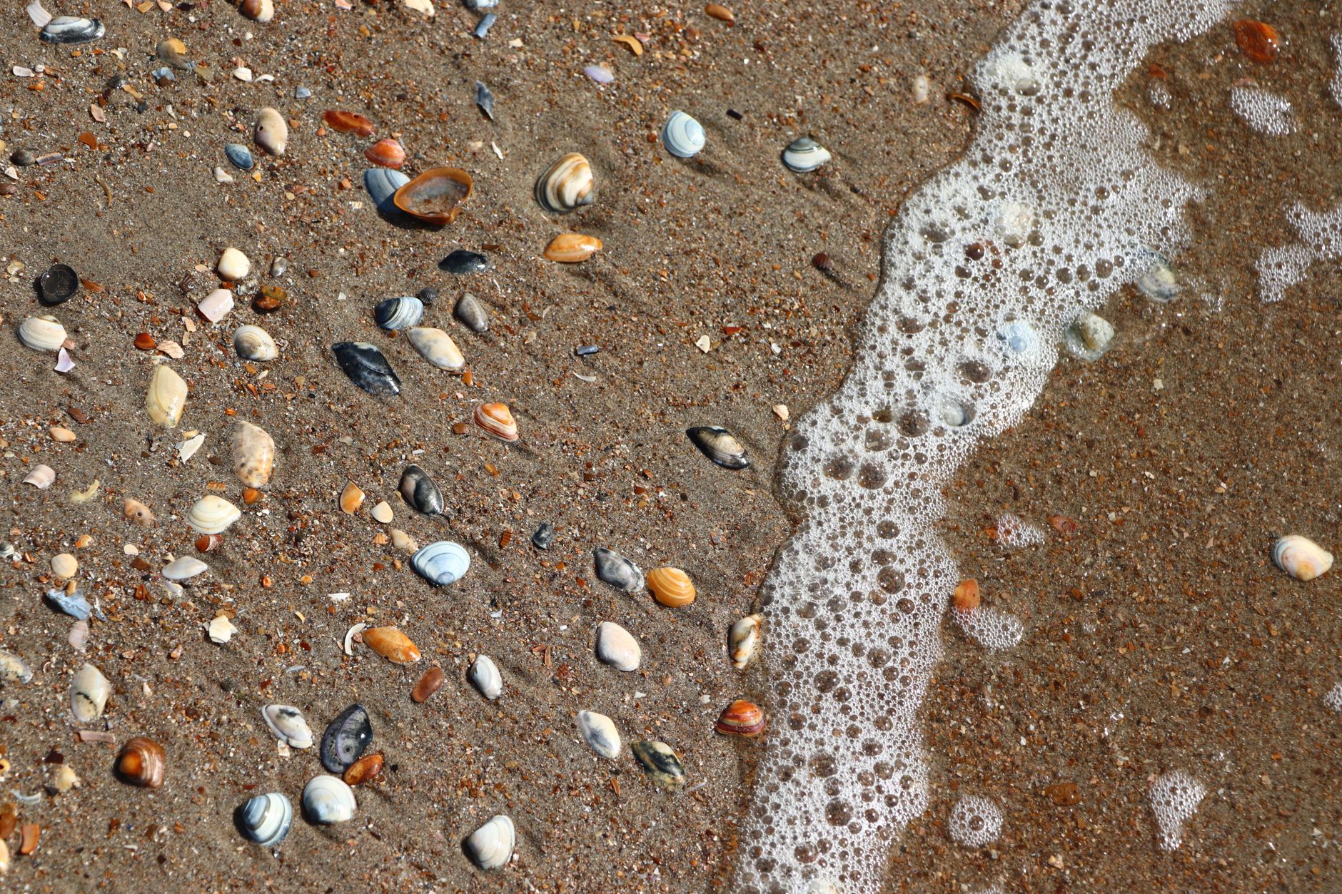
The Gulf shoreline here is a shelling coast, not a surf coast. Wave energy on this stretch is typically modest, and the sand tends to run coarser and more shell-heavy than the fine quartz beaches further north toward Sarasota. That is a feature for some buyers and a drawback for others. If your picture of a beach morning involves barefoot walking on powder, it is worth actually standing on the sand before you commit — the texture is genuinely different.
Shelling is best in the hours after a strong onshore wind or a passing front, and the south end near the pass tends to accumulate more material because of how water moves through Boca Grande Pass. The deep pass at the island’s south end is the same feature that makes this a legendary tarpon fishery, and it shapes sediment transport along the lower island. If you want more on how the pass and the sound behave differently, our comparison of Boca Grande Pass and Gasparilla Sound goes into the water side of that in detail.
Sea turtle nesting season on Florida’s Gulf coast generally runs from May 1 through October 31, and Gasparilla Island takes it seriously. Expect marked nests on the beach, and expect lighting rules that govern exterior fixtures on beachfront and near-beach homes during those months. If you are buying a Gulf-side property, ask specifically what lighting compliance the home currently has — retrofitting fixtures is not expensive, but discovering the requirement after closing is an avoidable annoyance.
Walking and Bike Routes Along the Coast
The Boca Grande Bike Path runs most of the length of the island along the corridor of the former Seaboard Air Line railroad. It is flat, shaded in stretches, and it is genuinely the spine of daily life here. Residents use it to reach the village, the beaches, and the north end without a car. Touring the public beach accesses is worth building into that itinerary, and our a full corridor tour plan for buyers shows how to sequence the stops efficiently.
Golf carts are a normal mode of transport on Gasparilla Island, used on many island streets under local rules. When you tour homes, pay attention to two things people forget: whether the property has a practical, covered place to keep a cart, and how the property connects to the bike path. A home three blocks from the path with an awkward crossing feels farther away than the map suggests.
How Beach Proximity Affects Home Searches
There are effectively four tiers of relationship to the beach on this island, and they behave very differently as purchases.
Direct Gulf frontage. The shoreline is yours to walk out onto. It also comes with the most exposure: salt, wind, lighting rules, dune and coastal construction oversight, and the highest ongoing maintenance burden of anything on the island. Read our notes on salt-air maintenance for coastal homes before you assume a beachfront home maintains like an inland one.
Gulf-view, second row. Often a meaningful step down in carrying cost with much of the visual benefit, but views are only as durable as what stands between you and the water. Verify what could be built or rebuilt in front of you.
Village walkable. Inside the historic village, where you walk to the beach, to dinner, and to the path. For many buyers this is the strongest quality-of-life value on the island, and it is the tier that holds its appeal even when someone eventually stops using the beach daily.
Bay side and interior. Facing Gasparilla Sound rather than the Gulf, or set within the island’s interior. Sunrise instead of sunset, calmer water, and frequently the better answer if a dock matters more than sand. Buyers weighing that tradeoff should read our island versus mainland living comparison as well.
Conservation Areas and Protected Stretches
A significant portion of the island’s southern shoreline is inside Gasparilla Island State Park and will not be developed. That permanence is worth real money to nearby owners, and it is one of the few view protections on a barrier island that does not depend on a neighbor’s intentions.
Elsewhere, dune systems, coastal vegetation, and the state’s coastal construction control line regulate what can be built, rebuilt, or extended toward the water. Before you plan any addition, pool, or seawall work on a Gulf-side lot, find out where the property sits relative to that line and what state-level review would apply. This is a question for the county and the state, not for a listing description.
Touring the Island Beach by Beach
The most useful thing you can do as a buyer is spend one full day on the island doing nothing but this: park at the state park in the morning, walk north, stop at each public access, and note where the sand changes and where the crowds are. Then ride the bike path from the south end to the north end. By the afternoon you will know whether you want to be in the village, on the north end, or on the bay side — and that single decision narrows the search more than any price filter will.
When you are ready to look at specific properties with that framework in hand, get in touch with Sabatino Campilii. Walking the island with someone who can connect what you are seeing on the sand to what the county records and the survey actually say is the fastest way to turn a general interest in Boca Grande into a decision you feel settled about.
Start with Boca Grande homes and island living for the current picture of what is available and what it costs to own here. Beach access is one part of a much broader lifestyle shift, which our Boca Grande island living buyer’s guide covers in full.
Sabatino can answer it in five minutes — no pressure, no listing-agent spin.

Realtor®, License SL3363040
25-year builder, developer, and licensed Realtor® representing buyers and sellers across the Southwest Florida Gulf-coast pockets. Reviewed and published June 28, 2026.
Have Sabatino represent you — before you call any listing agent.